6 Minute read
Land rights are the cornerstone of world economies. University of Melbourne researchers are helping the Indonesian government modernise their land information system. The road map towards better land administration is based on local needs as well as international best practices.
Key points
- University of Melbourne researchers have prepared a customised road map of 21 projects to modernise every aspect of Indonesia’s land information system for the Indonesian Ministry of Land Affairs and Spatial Planning (Kementerian Agraria dan Tata Ruang / Badan Pertanahan Nasional)
- Modern land information systems give clarity around land rights and support land administration, sustainable development and urban planning
- The University of Melbourne’s Centre for Spatial Data Infrastructures and Land Administration (CSDILA) has previously worked on similar projects with the Victorian Government, the World Bank and the United Nations Committee of Experts for Global Geospatial Information Management (UN-GGIM).
The outcome
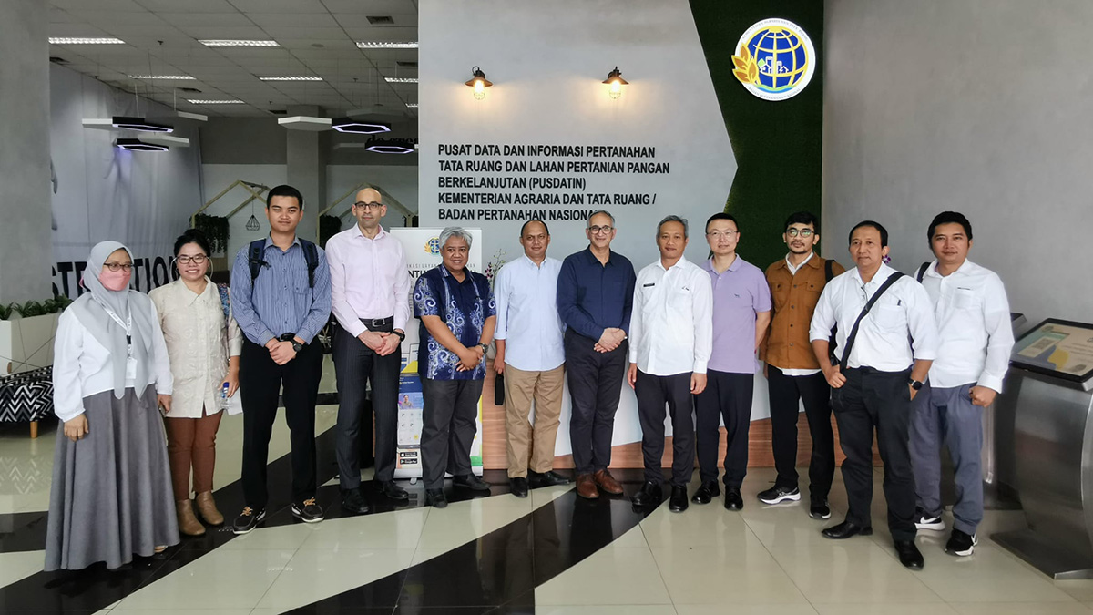
“The Centre for Spatial Data Infrastructures and Land Administration team is helping the Indonesian government to move from paper-based land administration to digital-based land administration,” says Professor Abbas Rajabifard, the lead of the land information modernisation project.
Land administration connects physical information about the land’s features with legal information about the rights, restrictions and responsibilities. This is done through a series of steps and protocols – all of which the research team has considered for modernisation.
Based on the Indonesian government’s vision and international best practices, Professor Rajabifard and his team have developed a customised road map of 21 projects to modernise Indonesia’s land information system.
The partnership has also included training and capacity building across the range of people involved in Indonesian land administration processes, from land surveyors to government executives.
“We are grateful for the training organised by CSDILA in 2020, which provided us with the opportunity to gain knowledge from CSDILA's experts in the field of land management and cadastre. This knowledge has allowed us to solidify our practical knowledge and increase the capacity of our staff to assist in the organisation of various activities in the Ministry,” says Himawan Arief Sugoto, Senior Advisor to the Minister.
The University of Melbourne team is now working on a pilot for a modernised land information system, called SmartLand Indonesia.
The need
Land rights form the basis of world economies. Modernising land administration gives clarity around land rights.
In disasters like floods or landslides, paper records can be lost or destroyed. The government may not know who the land rights should be returned to.
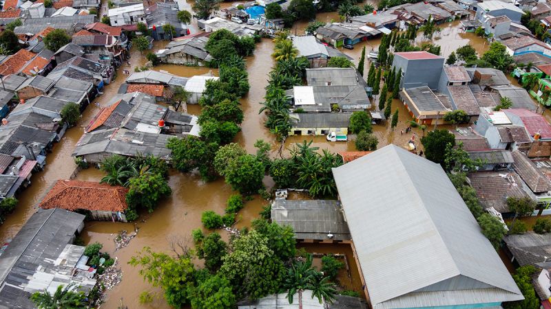
You may actually lose the ownership of the property. Dr Soheil Sabri, CSDILA
Digital records also allow more information to be stored and connected. And having complete land information available across jurisdictions is important for emergency management, urban planning and land management.
It could reveal a community’s resilience to natural disasters. For example, a community could be at risk of flooding due to the land’s topography and have poor access to road networks to escape.
Modern land information systems can also power sustainable development. Digital records allow governments to better analyse how land is distributed.
“The equal access to services and facilities is one part of the sustainable development indicators,” says Professor Rajabifard.
Many of the United Nations’ 17 sustainable development goals are connected to land. Better land information allows better measurement of progress towards those goals.
The research
The World Bank recognises land rights as a cornerstone of world economies. In 2018 and 2019, it sent a group of Indonesian executives to Melbourne for a workshop on best practices in land administration and what modernisation of land administration looks like.
The Indonesian Ministry of Agrarian Affairs and Spatial Planning asked the University of Melbourne team to support their project management office on their land system modernisation journey.
“We started exploring all the business processes on different levels – like the federal government, the regional, and also the local governments – in different jurisdictions across the entire Indonesia,” says Dr Soheil Sabri, the manager of the land information modernisation project.
Many changes are needed for a fully modernised land information system – even in law.
“For example, in the Indonesian context, the land title should be printed and stamped by the legal office,” Dr Sabri says.
To fully digitise the Indonesian land administration system, that law would need to change.
The road map built by the University of Melbourne proposed a suite of projects to address similar challenges and opportunities, modernising all aspects of the land administration workflow.
The road map, which has been thoroughly carried out by CSDILA, gives us an idea of the key activities we need to undertake to achieve the Ministry's digital transformation goals. Most importantly, the roadmap is our reference point for moving forward. Himawan Arief Sugoto, Senior Advisor to the Minister, Indonesian Ministry of Land Affairs and Spatial Planning
Beyond digitising a paper-based system, SmartLand Indonesia may eventually integrate digital twin technology. A digital twin – a virtual representation of real-world entities and processes, synchronised with its real-world equivalent – could help convert a 2D land information system into 3D, giving a more holistic view of structures such as high-rise buildings in areas like Jakarta.
Learn more about Infrastructure research
Developing the solution
The Centre for Spatial Data Infrastructures and Land Administration (CSDILA) was established in 2001. CSDILA was funded by the Victorian government land office to explore transitioning its paper-based land administration to a digital system.
The Victoria ePlan was a pilot project launched in 2016 in partnership with Land Use Victoria. It focused on the automatic validation of data collected and submitted to the land office.
“That is one of the flagship projects that converted the research into practice. Over those five years, the team has learned a lot of new knowledge and generated that knowledge as a repository for moving forward in different directions,” says Professor Rajabifard.
Developed countries like Australia and developing countries like Indonesia face different challenges in land administration. But work on the Victoria ePlan project helped CSDILA contribute to international land administration frameworks for the World Bank and the United Nations Global Geospatial Information Management (UN-GGIM).
These frameworks are internationally recognised references for developing, renewing, reforming, strengthening, modernising or monitoring land information systems. They help countries achieve sustainable development goals.
Work on these international land administration frameworks led to the CSDILA’s introduction to UN and World Bank member states, including the Indonesian government.
Partners
- Indonesian Ministry of Land Affairs and Spatial Planning (Kementerian Agraria dan Tata Ruang / Badan Pertanahan Nasional)
- Centre for Spatial Data Infrastructures and Land Administration at the University of Melbourne
Funding support
Publications
Jahani Chehrehbargh, F.; Rajabifard, A.; Atazadeh, B.; Steudler, D. (2023) “Performance Evaluation of Land Administration Systems-Implications of Global Initiatives” FIG Working Week 2023 International Federation of Surveyors (FIG).
Rajabifard, A. (2020) “Sustainable Development Goals Connectivity Dilemma”. Rajabifard, A. (Ed.) SUSTAINABLE DEVELOPMENT GOALS CONNECTIVITY DILEMMA: LAND AND GEOSPATIAL INFORMATION FOR URBAN AND RURAL RESILIENCE. CRC PRESS-TAYLOR & FRANCIS GROUP. Pp: 3-11. DOI: 10.1201/9780429290626-1
Rajabifard, A.; Potts, K.; Torhonen, M-P.; Barra, F.; Justiniano, I. (2020) “Leveraging National Land and Geospatial Systems for Improved Disaster Resilience”. Rajabifard, A. (Ed.) SUSTAINABLE DEVELOPMENT GOALS CONNECTIVITY DILEMMA: LAND AND GEOSPATIAL INFORMATION FOR URBAN AND RURAL RESILIENCE. CRC PRESS-TAYLOR & FRANCIS GROUP. pp: 81-92. DOI: 10.1201/9780429290626-5
Sabri, S.; Rajabifard, A. (2020) “Spatial Enablement to Facilitate the New Urban Agenda Commitments for Sustainable Development”. Rajabifard, A. (Ed.) SUSTAINABLE DEVELOPMENT GOALS CONNECTIVITY DILEMMA: LAND AND GEOSPATIAL INFORMATION FOR URBAN AND RURAL RESILIENCE. USA. CRC PRESS-TAYLOR & FRANCIS GROUP. pp: 199-211. DOI: 10.1201/9780429290626-12
Scott, G.; Rajabifard, A. (2020) “SDGs Roadmap”. Rajabifard, A. (Ed.) SUSTAINABLE DEVELOPMENT GOALS CONNECTIVITY DILEMMA: LAND AND GEOSPATIAL INFORMATION FOR URBAN AND RURAL RESILIENCE. CRC PRESS-TAYLOR & FRANCIS GROUP. pp: 13-44.
People
- Professor Abbas Rajabifard
- Dr Soheil Sabri
- Dr Behnam Atazadeh
- Dr Benny Chen
- Fatemeh Jahani
- Yuke Xie
First published on 20 November 2023.
Share this article
Keep reading
-
Explore more Infrastructure research
Transforming the planning, delivery and management of sustainable infrastructure for future generations.
-
Why partner with us
Partner with the University of Melbourne. Join a community where the world’s best minds help solve the biggest global challenges of our time.
-
Collaborate with us
Explore some of the many ways you can partner with us to help your organisation excel.
-
Decarbonising our cities
Cities are a major source of carbon emissions. Our expert panel discussed how we’ll reduce the climate impact of the built environment.